Introduction
The contents of a satellite image pixel are rarely homogeneous. An area 30x30m in size might include:
- buildings, trees, and roads in urban environments
- grasses, soils, and char in recently burned landscapes
- canopies, shade, and downed trees in forests
These patterns all affect the reflectance measured by satellites, and it's important to be able to estimate the sub-pixel abundances of each of these land cover types to better understand environmental gradients over large areas.
Spectral Mixture Analysis
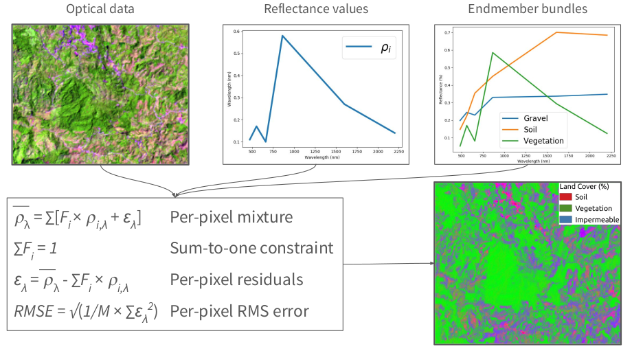
Spectral mixture analysis quantitatively estimates the sub-pixel contents of a pixel based on a set of representaive reflectance spectra (a reference library, in other words).
Spectral mixture analysis uses an iterative, least-squares fitting approach to estimate the proportions of land cover types based on observed reflectance measurements.
In order to run these analyses, you need:
- a high quality reference library of different land cover types
- to resample these reference data to the wavelengths of the instrument you plan to analyze
To support these analysise, earthlib provides a rich spectral library with thousands of labeled reference spectra and tools for working with common satellite instruments.
Next, learn more about the earthlib data sources.