Clarity through intention
To write clearly is to think clearly; to design clearly is to see clearly. Below are some visual designs and systems I’ve developed for mapping our changing planet.
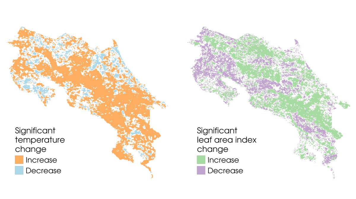
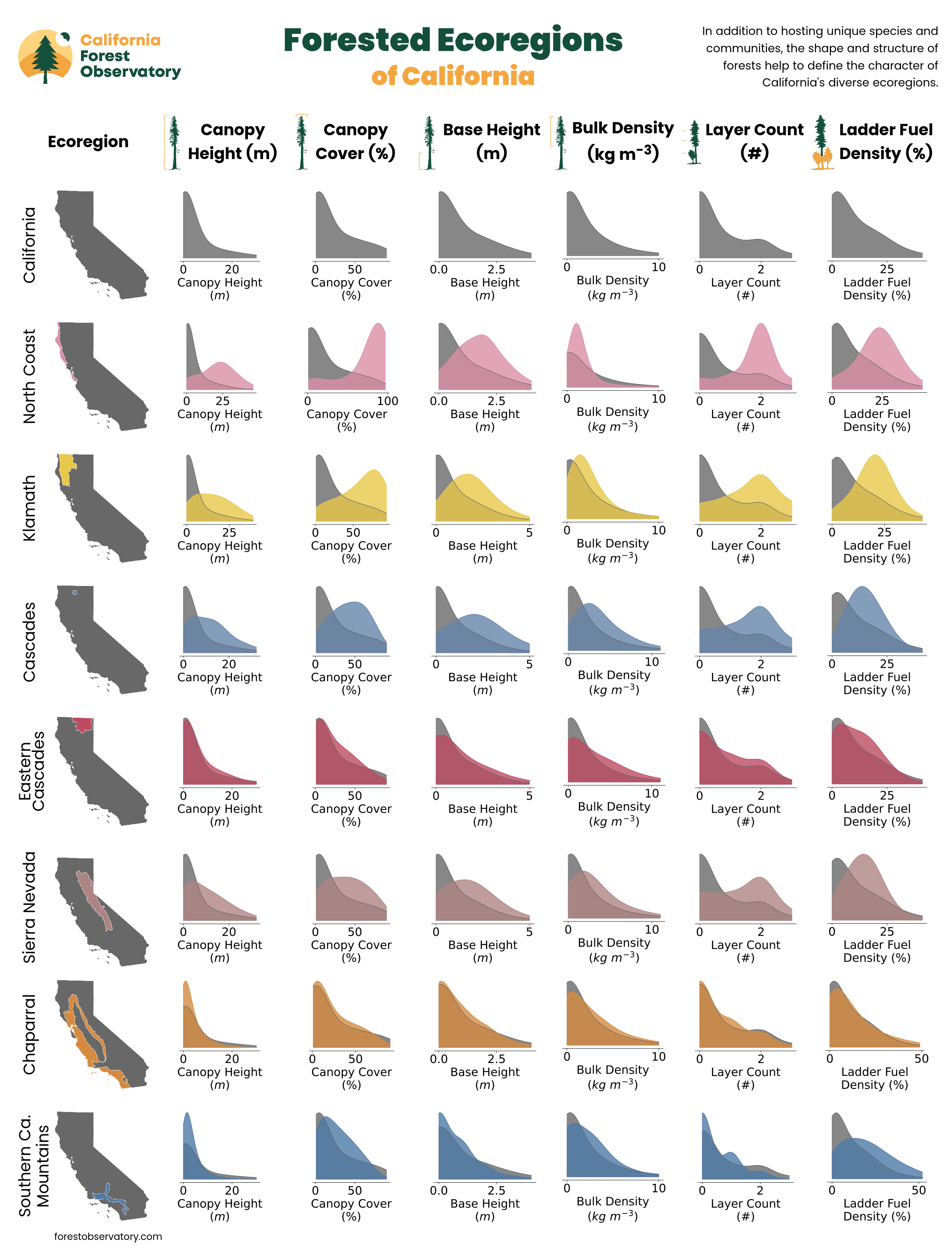
The Forest Observatory is a data-driven forest monitoring system, mapping the drivers of wildfire hazard across the state—including canopy structure, weather, topography & infrastructure—from space.
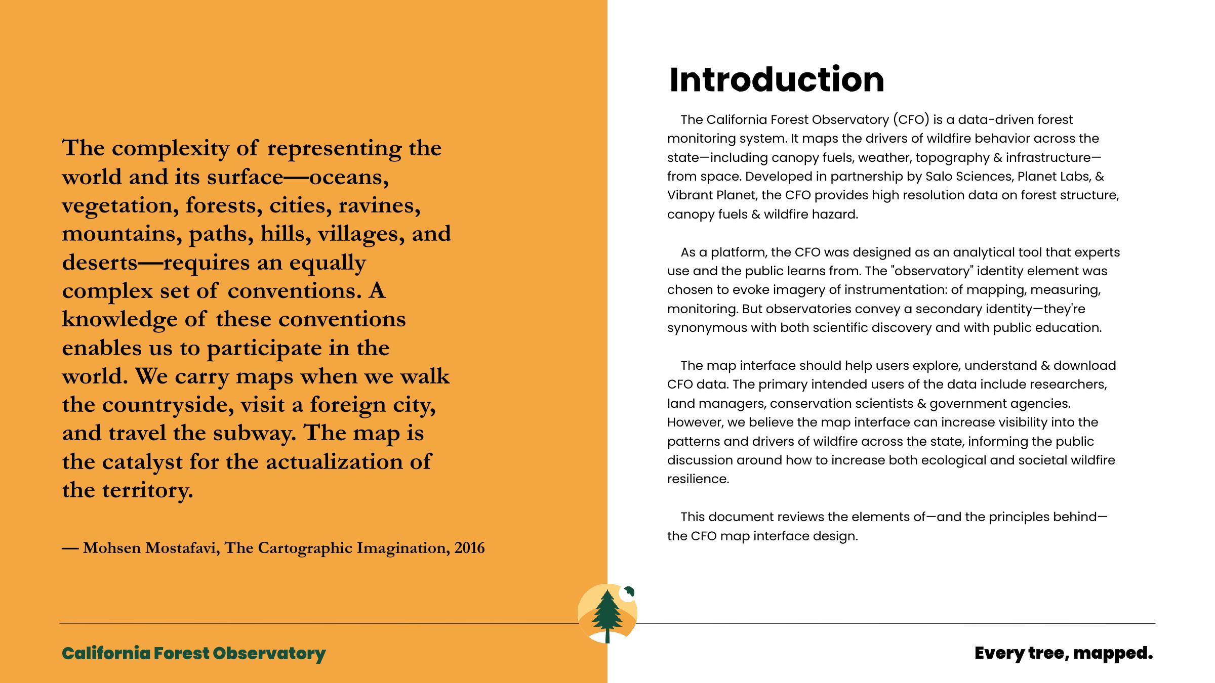
We chose the Observatory as the central identity element because we wanted the monitoring system to be a tool that experts use and that the public can learn from. This required strong didactic and technical design.
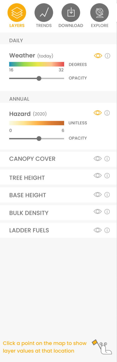
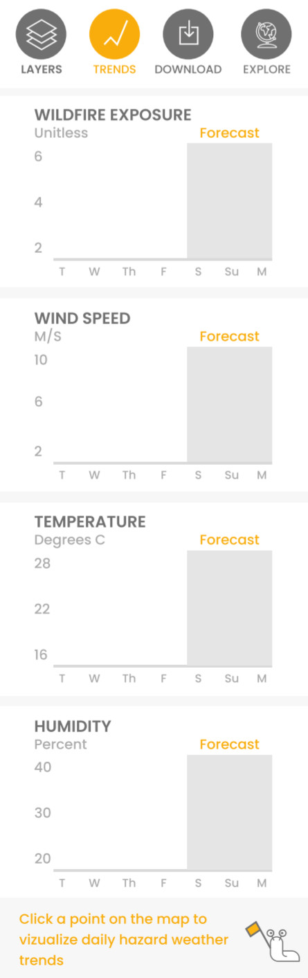
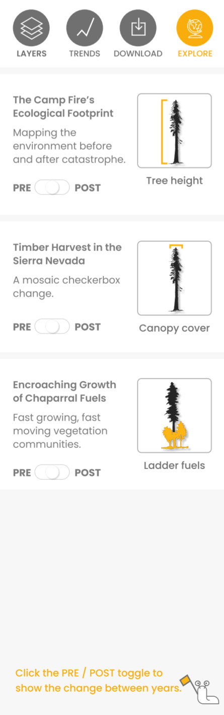
The interface was designed to be simple and intuitive. Our goals were to help users visualize, understand, and access the highest quality information on how forest structure and wildfire hazard vary over space and time.
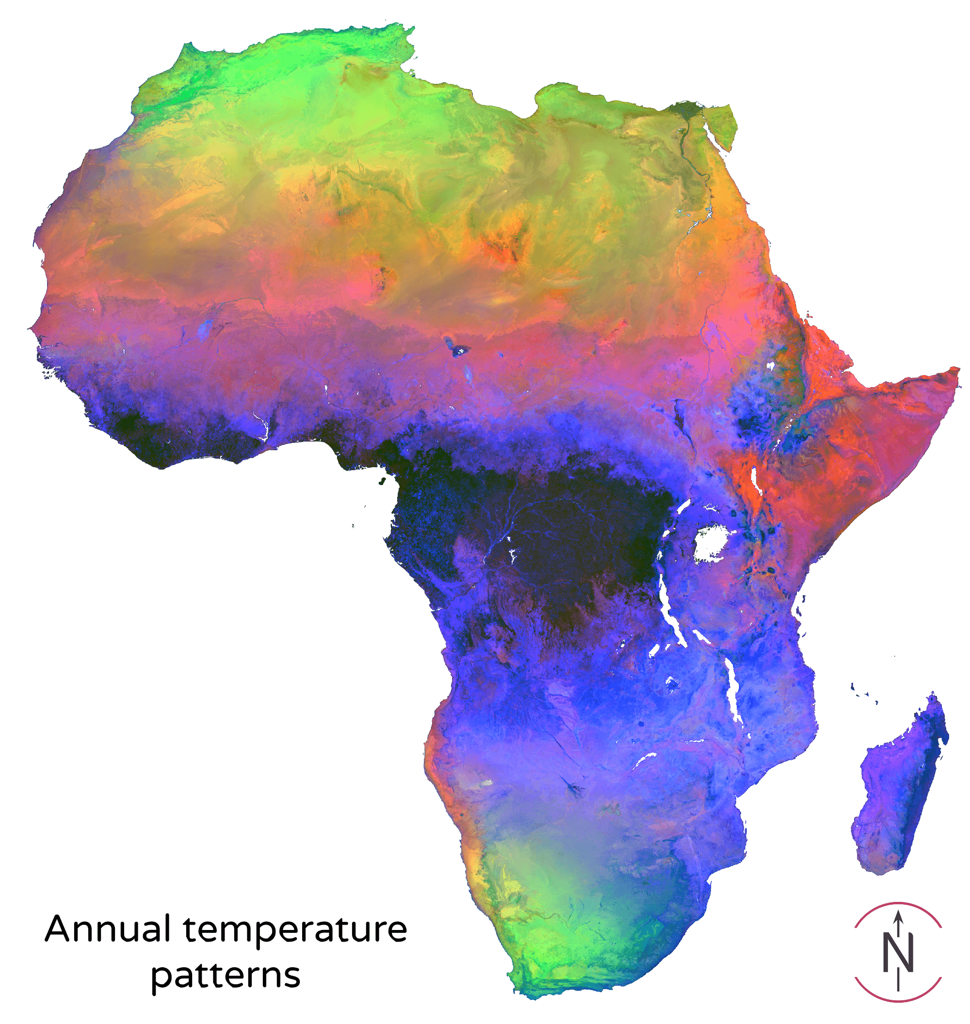
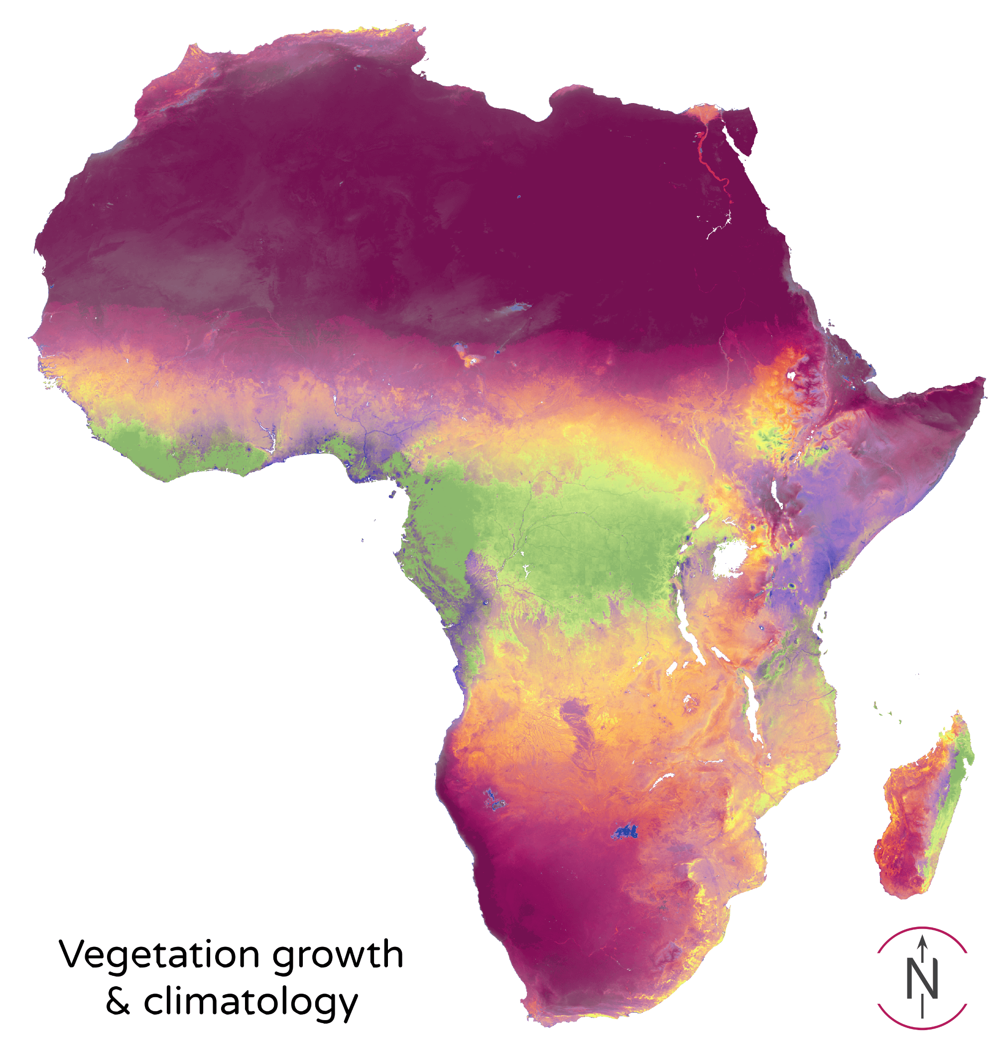
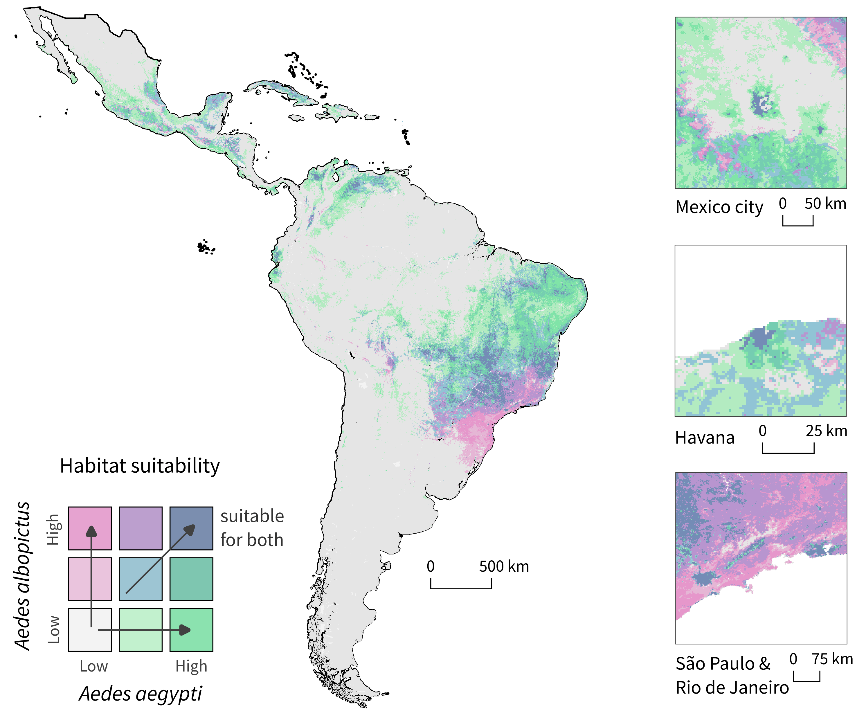
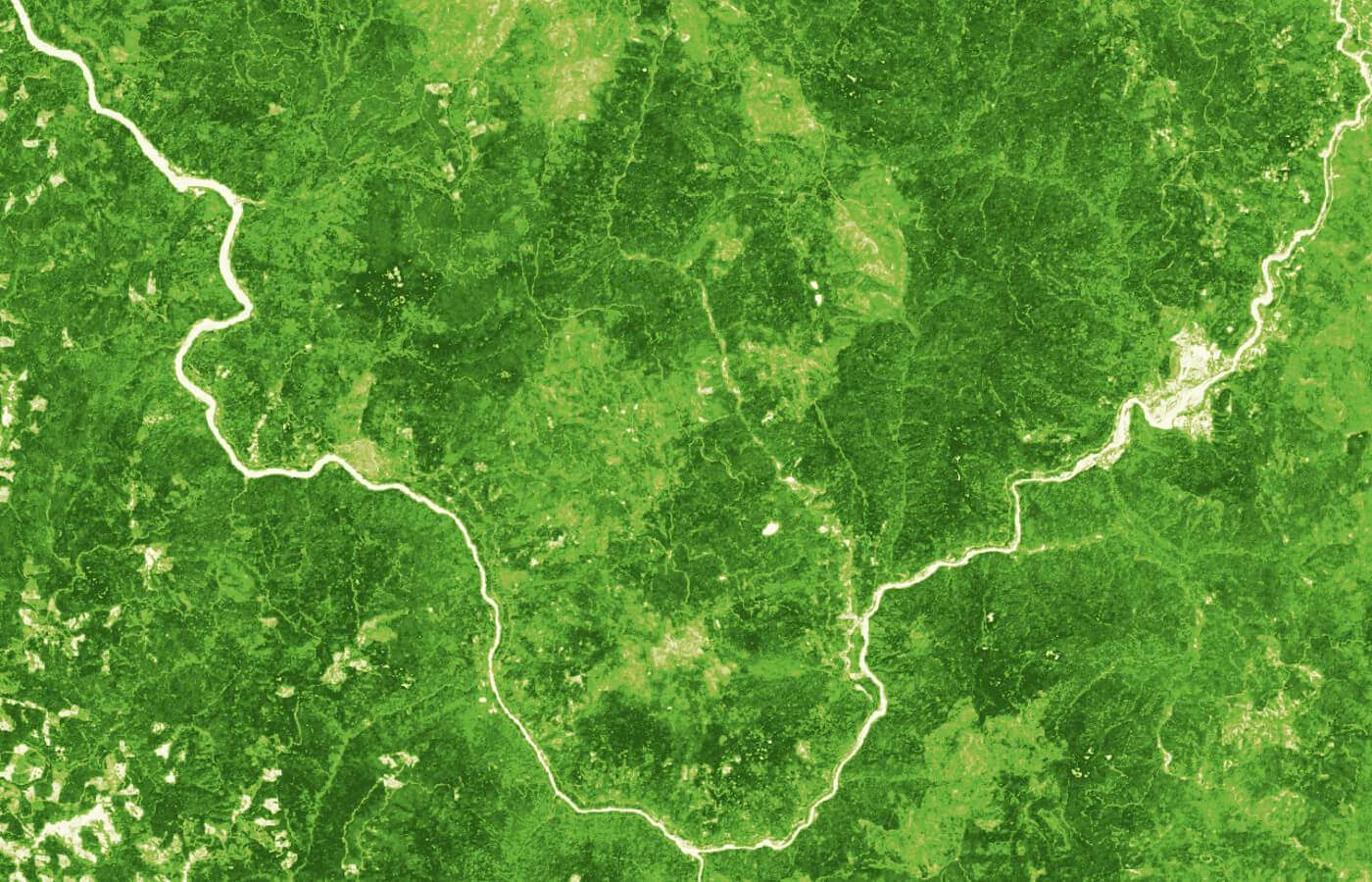
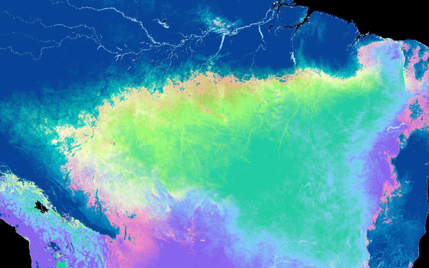
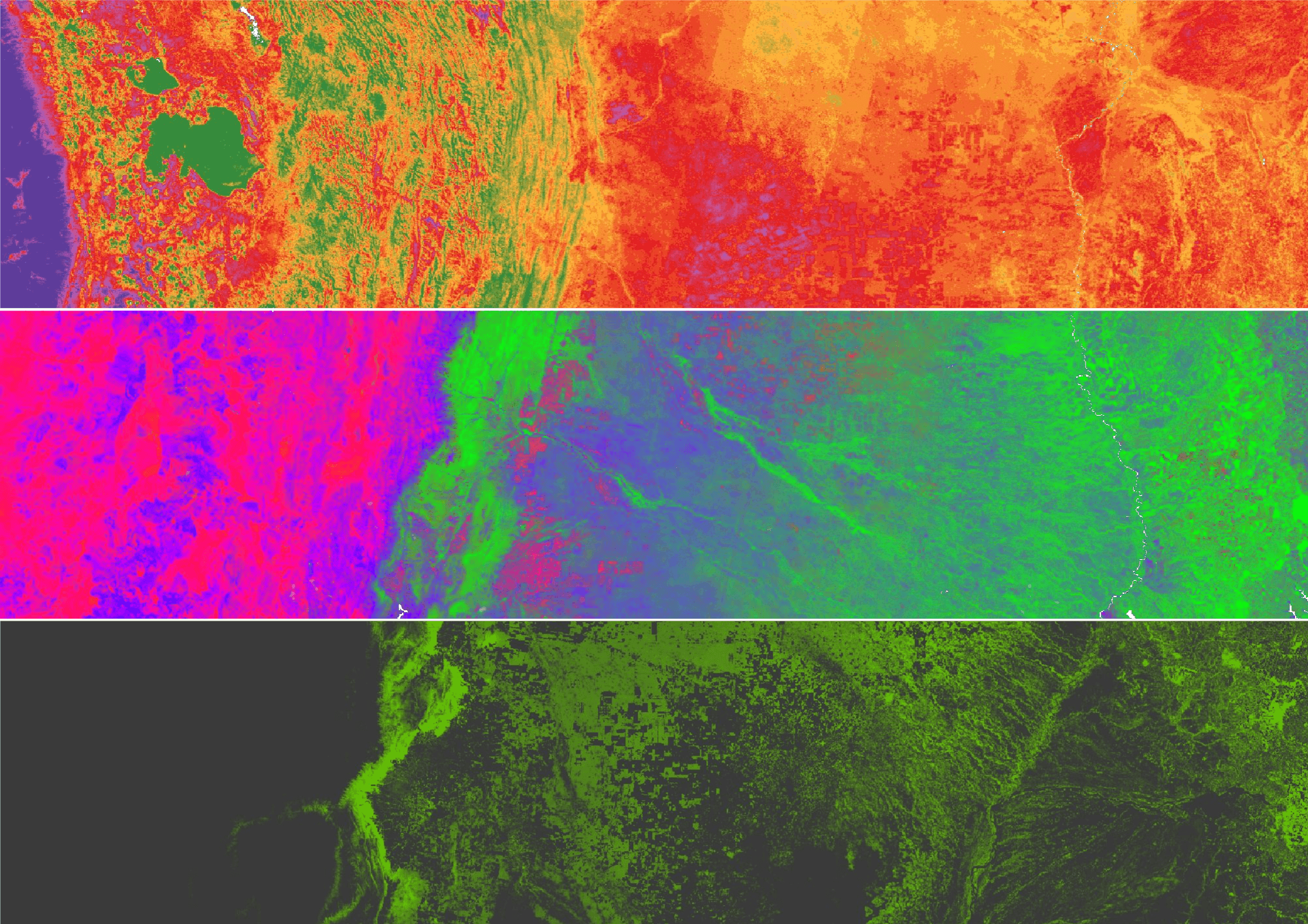
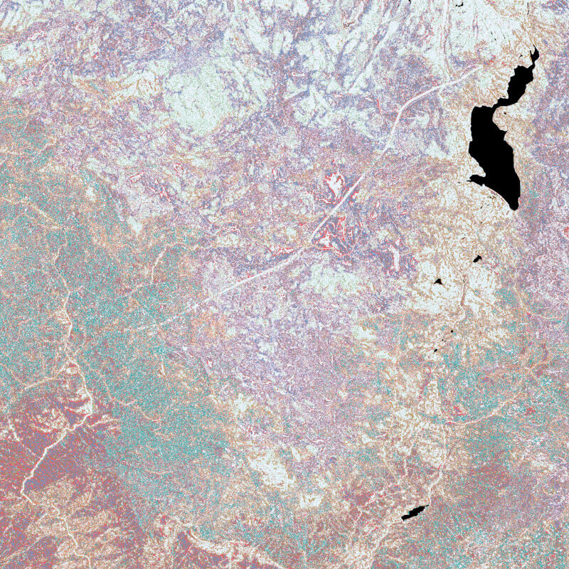
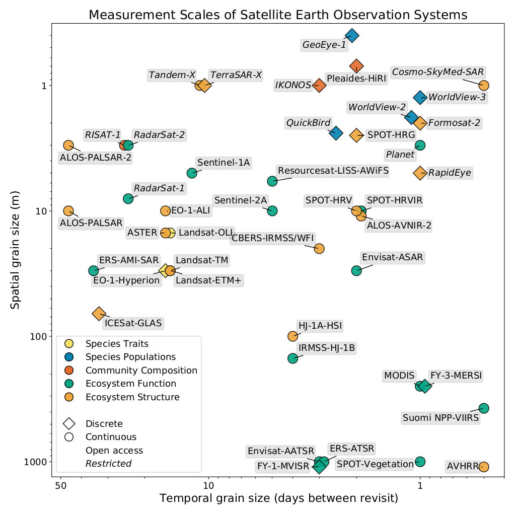
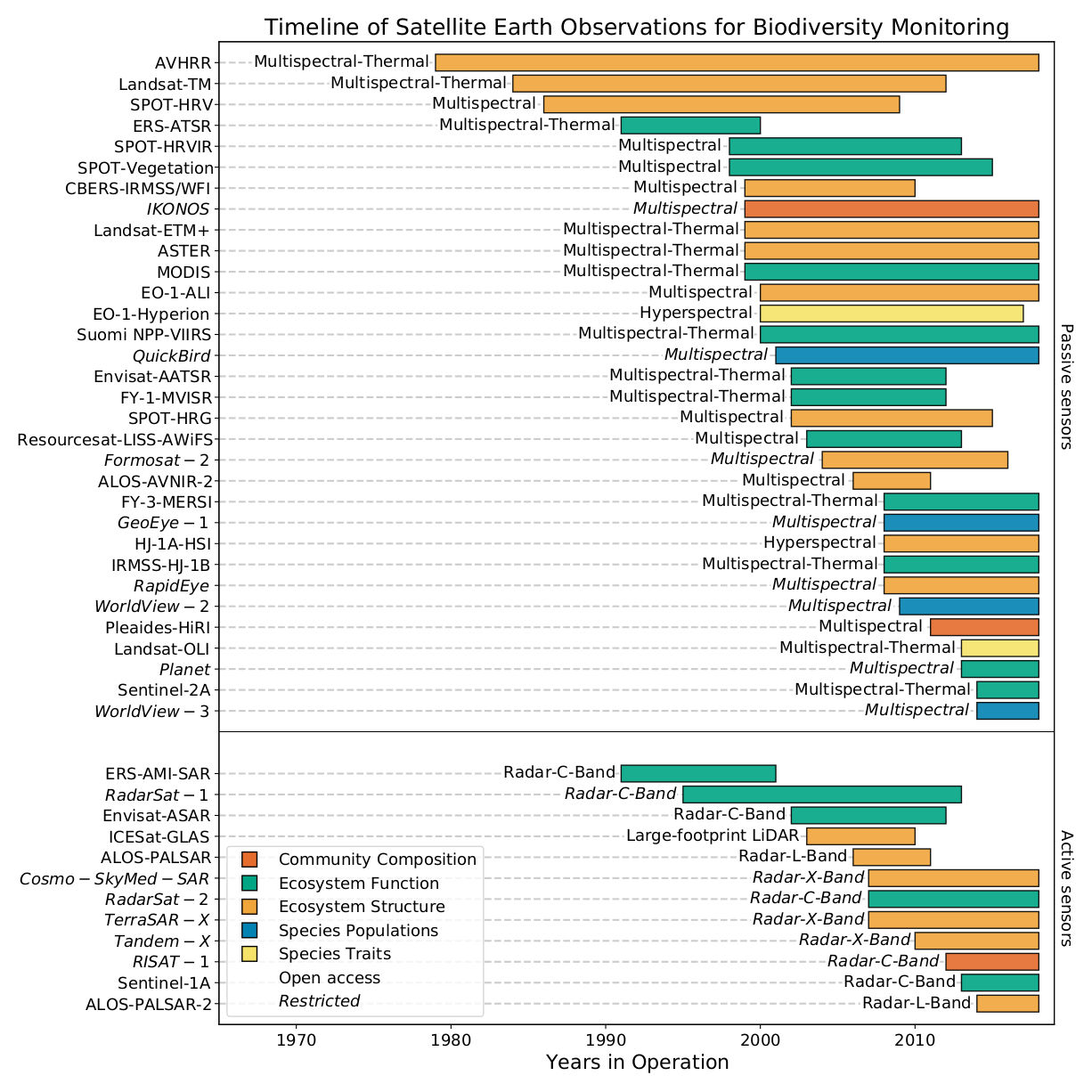
We use pattern recognition algorithms to map forest structure using satellite imagery. These algorithms identify and learn complex representations of spatial and biological organization.
Patterns in satellite images resemble biological cells—like mapping the earth with a microscope.
![]()